
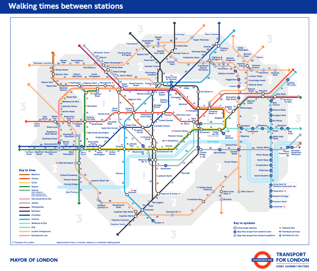
TfL has an alternative version of the Tube map, called ‘Walk the Tube’ which shows how long it takes to walk between stations in Zones 1 and 2.
“What we have seen is that people are desperate for this sort of thing, so we have created it,” says a spokespersons for TfL. ” We’re investing heavily in improving walking and cycling routes across London, with all the health benefits they bring. This is going to be great for people to see how quick and easy it is to so many stations.”
We can’t help thinking it might have been better to release this on a sunny day in April but if you fancy trying to catch rainbows between the showers its probably worth giving it a go.
You can access a full- sized version is here.
Related Posts
Last Trains Home – Easy timetable


Photos © Chorleywood Magazine